Sign up for our free daily newsletter
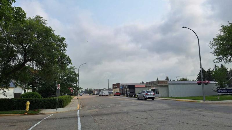
The smoky conditions will continue across most of the province for several days. (Cam Lee/northeastNOW Staff)
Smoky and warm

Warm, smoky conditions to stick around for a few more days

Jul 22, 2024 | 10:59 AM

Anyone looking for relief from the smoky, hot conditions will have to wait for a while.

The smoke has led to a special air quality statement being issued by Environment and Climate Change Canada for much of the province, along with the continued heat warning still in effect.

“The combination of heat and very poor air quality in smoke will increase the risk to your health,” the air quality statement read.

Meteorologist Brian Proctor told northeastNOW active wildfires in northern Saskatchewan and Alberta are producing the smoke, with the stagnant weather pattern allowing it to blanket the province. Proctor said the smoke drifted east but has since returned.

“We’re just recirculating a lot of that smoke as much as anything else across much of the province at this point in time,” explained Proctor. “It’s really going to continue to be problematic for us moving forward until we manage to…get out (from) underneath this upper ridge that’s really sort of locking conditions in.”

Proctor said the smoke has drifted down in the atmosphere, which has led to a greater concentration. The fact there has been little wind hasn’t helped, either.

There isn’t much change on the horizon until toward the end of the week, as a system comes through pushing the current system to the east. That change will result in the smoke dissipating late Thursday, and slightly cooler temperatures. Daytime high temperatures across the province have been significantly above normal for the past week or so, and that will continue for the next couple of days. The warm weather has also stuck around in the overnight hours.

“We’re not getting a lot of respite from the heat and smoke at all, so we’re being plagued with that heat and smoke during the daytime hours and overnight things are remaining warm and very stagnant,” said Proctor. “People are not getting a chance to recover from the daytime highs they’ve been experiencing.”

Temperatures will be near normal Thursday through the weekend, but Proctor said the warmer conditions should return for the last week of July into August.

The high for Monday in Melfort will be 29 C with a risk of a thunderstorm this afternoon. Temperatures are expected to be in the mid to high 20s and low 30s until Thursday. There will be further risk of showers later this week.

With the warmer temperatures persisting this week, a spokesperson for SaskPower said it’s possible, if not likely, they will set a new usage record this week.

The summer record is 3,669 megawatts, and while loads have been high, the closest we have come so far was on on July 11 with 3,655 megawatts.

Cam.lee@pattisonmedia.com

On X: @northeastnow_SK

View Comments