Click here to sign up for our free daily newsletter
(Image Credit: Water Security Agency)
WSA update

Warmer weather expected to prolong high flows, worsen flooding in parts of Saskatchewan

May 8, 2026 | 5:16 PM

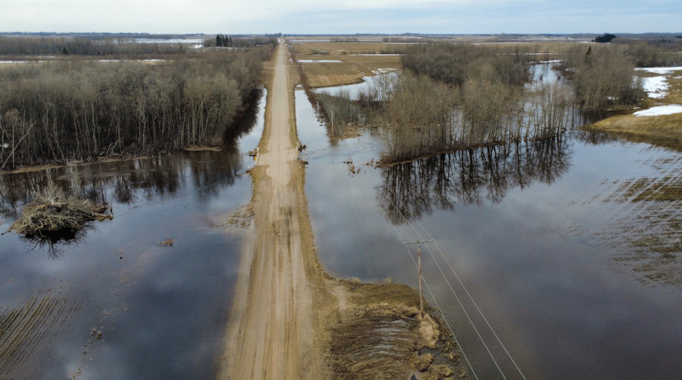
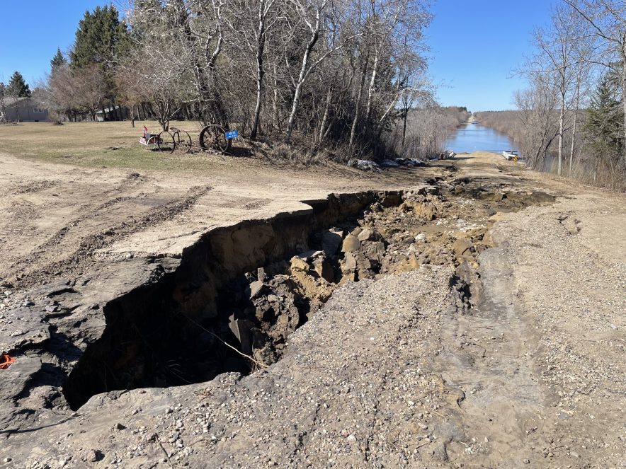
Warmer temperatures expected across east-central and northeastern Saskatchewan are set to prolong high water levels and could worsen flooding conditions in some regions already impacted by significant spring runoff.

In an update Thursday, the Saskatchewan Water Security Agency (WSA) said a combination of a late spring thaw, above-average snowpack and recent snowstorms continues to drive widespread flooding and runoff across the northeast and east-central parts of the province.

The WSA’s high flow advisory, first issued in April and updated earlier this week, remains in effect for the Quill Lakes, Carrot River and portions of the Assiniboine River basin.

READ MORE: Volunteers help Arborfield escape worst of northeast flooding

While some waterways have begun to recede, officials said several basins have not yet reached peak levels.

Areas north of the Assiniboine Basin with remaining snowpack could see another surge in flows as temperatures rise and melting accelerates. The WSA said some locations may see water levels similar to, or slightly higher than, previous peaks, particularly along the Assiniboine River at Kamsack.

The Carrot River has already peaked in its upper reaches, while lower sections are beginning to recede, though water levels remain elevated in several areas.

Further south, rivers and tributaries in the Red Deer River Basin continue to rise and are expected to peak in the coming days.

A view from above Paddockwood Road, near Prince Albert.
A view from above Paddockwood Road, near Prince Albert. (Image Credit: Nigel Maxwell/ paNOW Staff)

Near Prince Albert, active snowmelt is contributing to extremely high flows on the Sturgeon River. The WSA said nearby systems, including the Spruce and Garden rivers, are also expected to see significant increases.

Some areas are experiencing record-breaking flows. This video was taken near Garden River bridge near Paddockwood, north of Prince Albert.

At Smokey Burn on the Carrot River, water flow has reached nearly 1,000 cubic metres per second — about five times the normal seasonal rate. At Armley, flows have reached almost 400 cubic metres per second, compared to an average of about 70.

In the Quill Lakes basin, preliminary assessments suggest Ironspring, Magnusson and Quill creeks are also experiencing record flows.

The WSA said it continues to work closely with affected communities, providing updates, monitoring conditions and offering support as needed. Officials have made more than 1,200 proactive contacts with municipalities and local authorities in areas facing extremely high flows.

Flooding in the Rural Municipality of Garden River, Sask. on May 6, 2026.
Flooding in the Rural Municipality of Garden River, Sask. on May 6, 2026. (Image Credit: Marija Robinson/CKOM)

Across the province, communities have been working to protect infrastructure as flooding continues to impact roads, farmland and low-lying areas.

The Saskatchewan Public Safety Agency said it remains engaged with at-risk communities and is helping coordinate resources where required.

Provincial support programs, including the Emergency Flood Damage Reduction Program and the Provincial Disaster Assistance Program, remain available to help communities and residents affected by flooding.

— 

cam.lee@pattisonmedia.com