Click here to sign up for our daily newsletter.
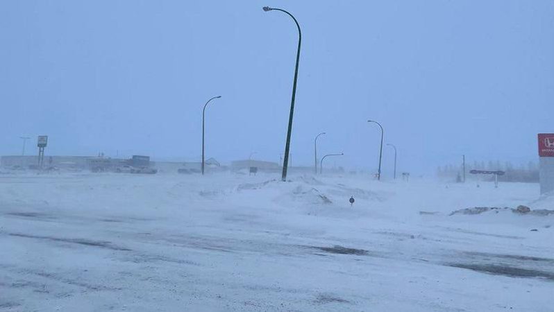
Travel conditions could be terrible across the province on Thursday. (File photo/northeastNOW Staff)
Alberta Clipper

Old Man Winter not quite done with Saskatchewan as snow approaches

Mar 26, 2025 | 11:06 AM

One last gasp of winter is heading our way.

The province will see an Alberta Clipper coming through on Thursday, bringing with it significant precipitation and strong wind.

Danielle Desjardins of Environment and Climate Change Canada said the system is expected to arrive overnight into Thursday morning in west-central areas of the province.

The system will then head east, largely following the path of the Yellowhead Highway through the central part of Saskatchewan.

Areas in that corridor, including North Battleford, Saskatoon, through to Yorkton could expect upwards of 20 cm of snow, with significant wind gusts of 60 km/h or more. The closer you are to that corridor, the more snow you will see.

“South of that, there is a chance that a band of freezing rain will develop,” Desjardins said. ”It could make for some pretty treacherous road conditions, with the heavy accumulating snow and also with the freezing rain.”

Late Wednesday afternoon, a snowfall warning was issued for a section of central Saskatchewan that stretched from the Wilkie and Unity areas, and east to the Manitoba border.

The strong wind, as mentioned, will also lead to some significantly reduced visibility in many areas, making travel conditions even worse.

“We are expecting really poor travel conditions Thursday into Friday, so if you can delay travel, that is recommended,” said Desjardins. She recommended having an emergency travel kit in your vehicle if you are driving during that time.

The Melfort and Prince Albert areas can expect to see between 5 and 15cm. of snow, though that could fluctuate. A weather statement issued on Tuesday was lifted on Wednesday afternoon.

Desjardins said the province has seen some mild weather over the past few days, and the incoming snow could melt for a little while. However, the heavy, wet snow should begin to accumulate quickly. Temperatures should drop below freezing on Thursday, which may also make roads and highways icy.

Most of the snow should fall Thursday into Thursday night, with some lingering flurries into Friday morning. Desjardins said the system will track out of the province by Friday afternoon. The wind should also die down Friday morning.

Temperatures will be slightly below normal into the weekend, and Desjardins said we should be above the freezing mark by Tuesday.

Cam.lee@pattisonmedia.com