Click here to sign up for our free daily newsletter
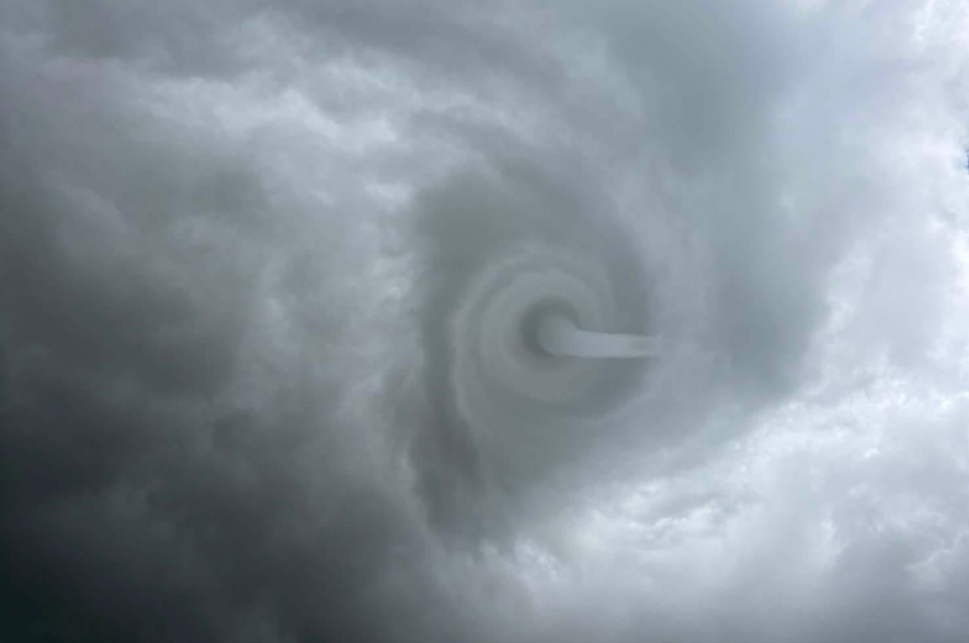
Tornado alerts have been issued for several areas, mostly in southern Saskatchewan. This funnel cloud was spotted near Spring Water, Saskatchewan which is in the R.M. of Biggar. It was reported a few hours prior to the tornado spotted in Edam Friday afternoon. (Image Credit: 306StormChaser/Facebook)
Weather warnings

UPDATE: Severe weather continues following critical alert for tornados

Jul 3, 2026 | 7:19 PM

UPDATE: A severe thunderstorm led to several critical tornado alerts being issued Friday afternoon by SaskAlert.

By 7:39 p.m., Environment Canada said the tornado warning covered much of South Central Saskatchewan.

“Extra care and attention should be exercised in and around the following localities: Spiritwood, Debden, Big River Reserve, Meeting Lake and Leask.”

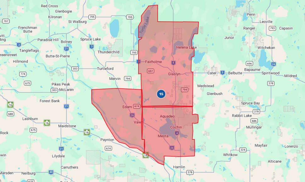
Tornado alerts had previously been issued for Saskatoon and Edam before that, where an alert said a tornado had touched ground.

The Sask Alert warnings, said the storm was moving northeast at 30 kilometres an hour. It warned that damaging winds, large hail and locally intense rainfall were also possible.

The weather agency said baseball-sized hail is likely and described the situation as very dangerous and potentially life-threatening.

A critical alert for the Edam area was cancelled around 5:30 p.m. Friday following reports that a tornado had touched the ground near the community. However, a different critical alert was issued shortly after – this time for an expanded area north of the Battlefords.

The critical Sask Alert notification sent around 5:49 p.m. indicated that Environment Canada meteorologists were tracking a cluster of severe thunderstorms capable of producing a tornado. Doppler RADAR indicated the severe thunderstorm was located about 5 kilometres north of The Battlefords and was moving toward the east at 20 kilometres per hour.

“In addition to a tornado, this severe thunderstorm is capable of producing hail to the size of baseballs and wind gusts in excess of 100 km/h,” the alert read

“This is a very dangerous and potentially life-threatening situation,” the alert warned.

Tornado warnings are issued when a thunderstorm is producing or is likely to produce a tornado. Damaging winds, large hail and locally intense rainfall are also possible.

The area under a Critical Alert for a tornado as of 4:05 p.m. Friday, July 3, 2026.
The area under a Critical Alert for a tornado as of 4:05 p.m. Friday, July 3, 2026. (Image Credit: SaskAlert screenshot)

Videos submitted to battlefordsNOW showed golf ball sized hail in the Cochin area.


Golf ball sized hail hit the Cochin area around 5 p.m. Friday, July 3, 2026.

While videos posted on social media showed extreme weather conditions just west of Meadow Lake Friday afternoon around 3 p.m.


Lonnie Alm from Metinota, west of Meota, submitted this video from Jackfish Lake around 5 p.m. Friday.

Localized flooding prompted the City of Meadow Lake to barricade some streets Friday evening and warn residents to stay off flooded roads.

As the storm moved through the province, critical alerts for tornadoes were cancelled and then reissued for other areas. As of 6 p.m. many areas also continued to be under a severe thunderstorm warning. Environment Canada said conditions remain favourable for the development of severe thunderstorms that may be capable of producing strong wind gusts up to 90 km/h, large hail and heavy rain.

A possible landspout tornado forming near Springwater west of Biggar on July 3, 2026.
A possible landspout tornado forming near Springwater west of Biggar on July 3, 2026. (Image Credit: Submitted/Jessie Barber)

Scattered thunderstorms and severe thunderstorms developed as a trough of low pressure continued to linger over much of southern and central Saskatchewan Friday afternoon.