Click here to sign up for our free daily newsletter
Environment and Climate Change Canada confirmed a tornado touched down near Dundurn on July 10, 2026. (Image Credit: @RathrBStrmChsng/X)
Twister count climbs

Ten tornadoes reported across Saskatchewan Friday, more possible Saturday

Jul 11, 2026 | 12:32 PM

A low-pressure system that moved through Saskatchewan Friday afternoon triggered a severe weather outbreak, producing several severe thunderstorms, numerous reports of funnel clouds and possible tornadoes, including one confirmed tornado near Dundurn. 

Environment and Climate Change Canada (ECCC) is collaborating with the Northern Tornadoes Project to further investigate reports of tornadoes in Speers, Patrofka, Sunset Estates, Colonsay, Rosthern, Plunkett, Prud’homme, Smuts and Cupar.  
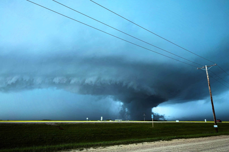
This unconfirmed tornado near Waldheim caused damage to the town and surrounding area.
This unconfirmed tornado near Waldheim caused damage to the town and surrounding area. (Image Credit: Gina Gardipy/Facebook)

Very large hail and strong winds were reported at numerous locations across the province, causing extensive damage to houses, roofs, trees, power lines and other structures. Significant damage was reported in Speers, a village about 50 kilometres southeast of the city of North Battleford on Highway 40. Pictures of downed trees and powerlines were circulating from the Waldheim area. Wind damage was also reported in Rosthern and Hague. 

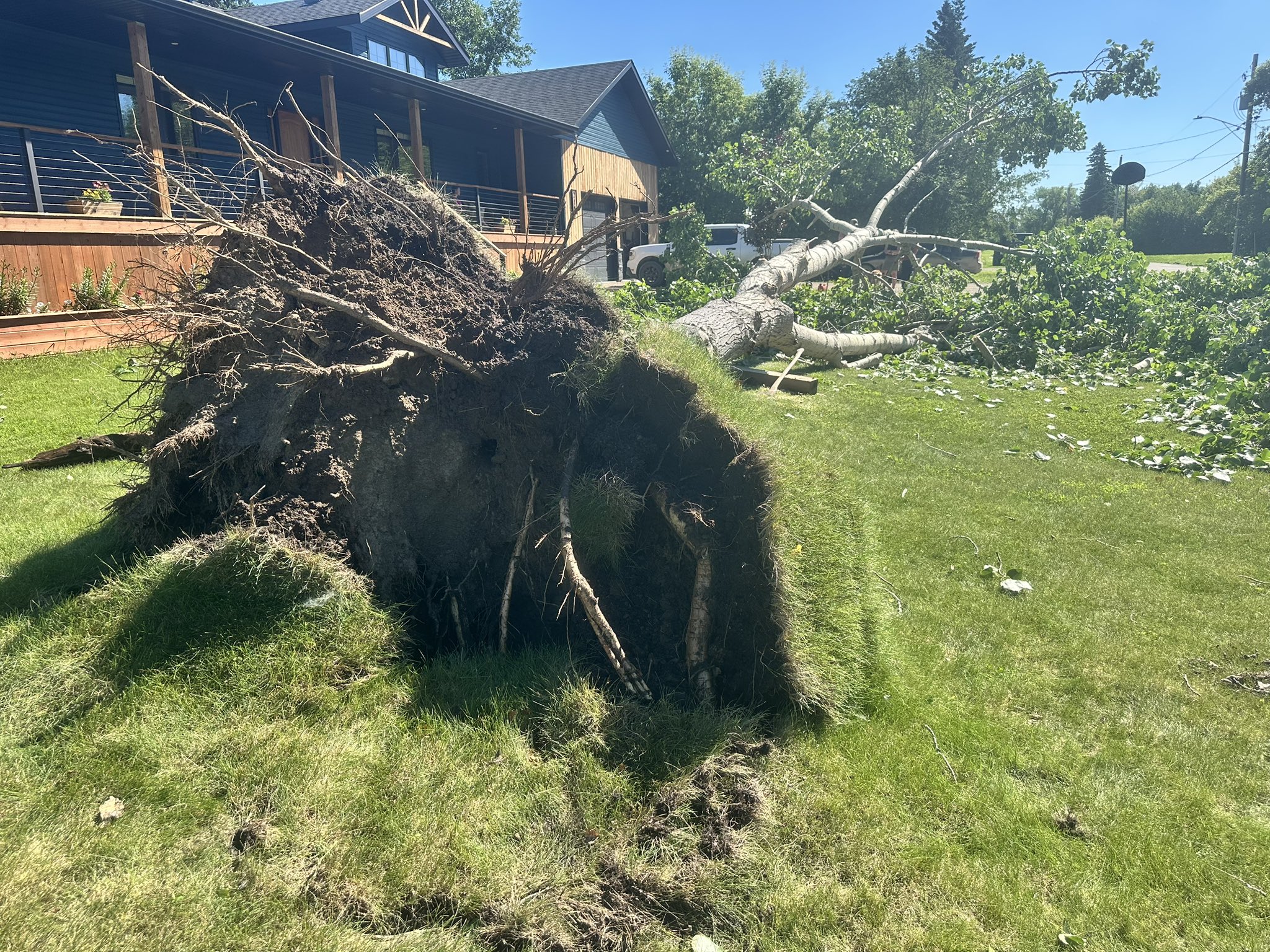
Waldheim families are in clean-up mode today, dealing with uprooted trees, trampolines in trees and branches galore covering lawns, roads and roofs.
Waldheim families are in clean-up mode today, dealing with uprooted trees, trampolines in trees and branches galore covering lawns, roads and roofs. (Image Credit: Libby Gray/CKOM)
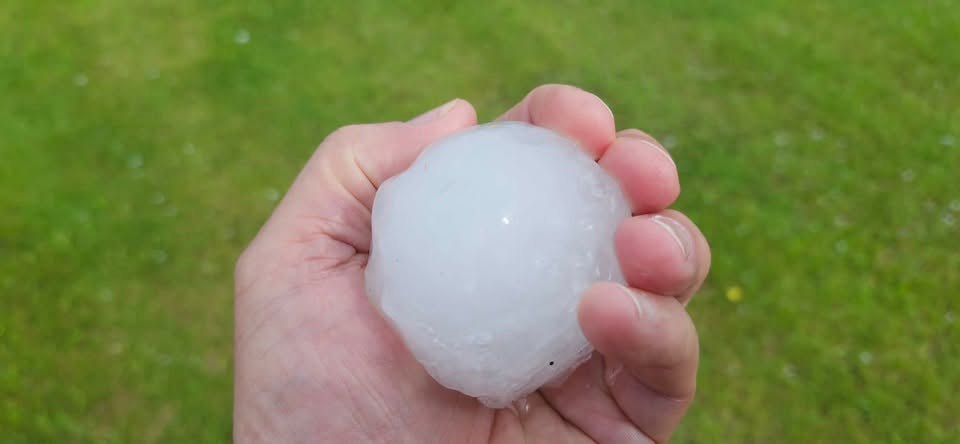
Saskatchewan Severe Weather Tracker Facebook group member Sarita Mar posted this photo of hail that fell near Waldheim on July 10,2026.
Saskatchewan Severe Weather Tracker Facebook group member Sarita Mar posted this photo of hail that fell near Waldheim on July 10,2026. (Image Credit: Saskatchewan Severe Weather Tracker/Facebook)

Meteorologist Kayla Bilouos said north of Saskatoon was hardest hit. She pointed to a weather summary that showed hail was the size of ping-pong balls to golf balls in Dundurn, Hafford, Bluementhal and Hague, while Plunkett, Allan, Hague and Waldheim saw hail from the size of a hen’s egg up to the size of a baseball. 

“When warm and really moist air sits over the area and then we get these low pressure systems that come through, that’s what is triggering all this severe weather and we are actually expecting more severe weather today,” Bilous explained. “There’s a low pressure system over Alberta right now and that’s going to track into the province of Saskatchewan triggering some storms later this afternoon and this evening with the potential of tornadoes again today.” 

Bilous added, “We have definitely seen more severe weather days this year.” 

By June 30, Saskatchewan residents had already received 93 alerts for tornadoes according to Canada’s emergency alerting system Alert Ready. Dozens more have been issued in the last two weeks alone.  

Professional tornado hunter Greg Johnson said from his perspective, it’s pretty spectacular to have 10 reports of tornadoes in one day.  

While it may feel as though Saskatchewan has become North America’s tornado alley, it’s not the first time the province has seen such a significant number of tornados. In 2012, Saskatchewan had more tornadoes than Oklahoma did.  

“That’s not entirely uncommon. There are years where Minnesota gets the most tornadoes or Indiana. It really moves around,” he said. “And so, although its unusual, it’s not unprecedented for us to get the number of tornadoes that we’ve had.” 

Johnson said tornadoes come in all sorts of shapes, sizes, and varieties. Some are dangerous and can cause catastrophic damage, but most tornadoes, whether you are in Canada or the United States, are fairly weak and short-lived. 

“But when the conditions are right and you get the right atmosphere, you can actually have strong tornadoes in Canada just as much as you can have them in the U.S. and we’ve seen that in recent weeks in both Saskatchewan and Alberta, where we’ve had the right conditions,” Johnson said.  

“Today [Saturday], by the way, is another one of those days that we could see damaging tornadoes.” 

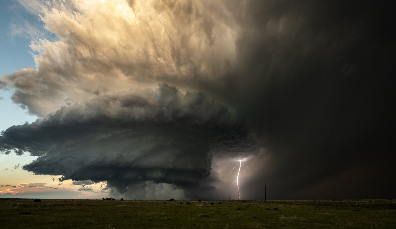
Tornado hunter Greg Johnson captured this supercell storm during a previous weather event in Saskatchewan. Johnson said conditions Saturday could again be favourable for tornado development.
Tornado hunter Greg Johnson captured this supercell storm during a previous weather event in Saskatchewan. Johnson said conditions Saturday could again be favourable for tornado development. (Image Credit: Submitted/Greg Johnson)

Supercell thunderstorms are the storms that spawn tornadoes, and Johnson said they have two very distinct parts to them. The downdraft is where the rain and hail happen, usually involving dark clouds with no light through them. The other part of the supercell is called the updraft.  

“It’s part of the supercell where the clouds are low, but it doesn’t even look like it’s raining. The updraft is where a tornado develops. So you know it rains and hails and then all of a sudden, the birds start chirping and maybe the sun even starts to shine…now you might be in the danger zone.” 

He said the best advice if you’re unsure about which part of the storm you are in, is to stay inside until the tornado warning clears.  

— 

panews@pattisonmedia.com